Skip to content

Garmin Oregon 750

Durable devices that go wherever you go and track your precise location in the process. Go farther than ever before when hiking and finding adventure.

Thanks to a redesigned antenna for better satellite reception, the Oregon 750 GPS and GLONASS handheld puts even more of the great outdoors at your fingertips. Whether you’re hiking, hunting, climbing, kayaking, trail riding or whatever, this rugged navigator is ready for anything. It features multilink wireless connectivity (Wi-Fi, Bluetooth and ANT+), active weather support with animated radar overlays and a built-in 3-axis compass with barometric altimeter.

Features

3″ Touch Screen

LivetRACKING

Live Geocaching

3D Electronic Compass

8MP Digital Camera

More Connectivity, Less Complexity

The expanded wireless capabilities of Oregon 750 make it easier than ever to download software, receive smart notifications¹ and upload adventures to Garmin Connect. You can even share LiveTrack location data or geocache discoveries, unit-to-unit, with other compatible Garmin handheld devices. Smart notifications via Bluetooth connectivity with a compatible smartphone let you receive emails, texts and alerts right on your device. So you can see what’s going on while you’re getting away from it all. Comes standard with a dual battery system that lets you use traditional AA batteries or a rechargeable NiMH power pack.

Rugged GPS/GLONASS Handheld with Built-in Wi-Fi®, Camera

Find Fun with Geocaching.com

The wireless Wi-Fi and Bluetooth links on your Oregon 750 makes it easier than ever to enjoy a superior geocaching experience. You can set your device to automatically stay up to date with all the latest caches from Geocaching.com. No more manual entry of coordinates or printing out cache details on paper.

Watch Video

Take Geotagged Pictures

Capture locations and memories with the 8 megapixel digital camera. Each photo is automatically geotagged, allowing you to easily navigate back to that exact spot in the future. You can upload and share your favorite photos with friends via Garmin Adventures™, part of the Garmin online community.

Enjoy the View on a Vivid Display

The Oregon 750 handheld features a bright, sunlight-readable 3-inch color touchscreen display with dual orientation for landscape or portrait views. It easily supports multiple mapping options such as BlueChart® g2 HD for water navigation or City Navigator® NT for turn-by-turn driving directions. Durable and water-rated to IPX7, the Oregon series is built to keep delivering vital mapping and tracking data, no matter what the elements throw at you. Plus, you can even customize your Oregon’s display with free downloads of apps, widgets and data fields from the Garmin Connect IQ™ online store².

Navigate Your Way

The Oregon 750 handheld provides comprehensive navigation and tracking to guide you on and off the beaten path, using GPS and GLONASS plus ABC (altimeter, barometer and compass) sensor capabilities. The built-in altimeter provides elevation data to accurately monitor ascent and descent, while the barometer can be used to predict weather changes by showing short-term trends in air pressure. The 3-axis electronic compass keeps your bearing, whether you’re moving or not. There’s also a TracBack® feature on Oregon 750 to help you navigate back to your starting point the same way you came. You can also mark locations, such as your campsite, vehicle or other points of interest, to which you’d like return navigation.

Specification

General
Dimension
2.4″ x 4.5″ x 1.3″ (6.1 x 11.4 x 3.3 cm)
Weight
7.4 oz (209.8 g) with batteries
Water rating
IPX7
MIL-STD-810
Display Type
transflective color TFT touchscreen
Display Size
1.5″W x 2.5″H (3.8 x 6.3 cm); 3″ diag (7.6 cm)
Display resolution
241 x 400 pixels
Battery Type
2 AA batteries (not included); NiMH or Lithium recommended; rechargeable NiMH pack (optional)
Battery life
up to 16 hours
Memory/History
4 GB
Interface
high speed mini USB and NMEA 0183 compatible
Maps & Memory
Ability to add maps
Basemap
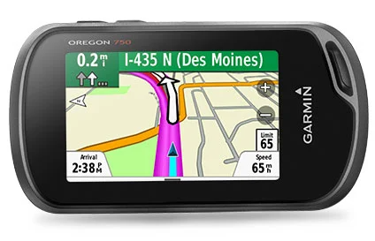
Automatic routing (turn by turn routing on roads) for outdoor activities
Yes (with optional mapping for detailed roads)
Map segments
15000
Includes detailed hydrographic features (coastlines, lake/river shorelines, wetlands and perennial and seasonal streams)
no (additional mapping needed)
Includes searchable points of interests (parks, campgrounds, scenic lookouts and picnic sites)
no (additional mapping needed)
Displays national, state and local parks, forests, and wilderness areas
no (additional mapping needed)
External memory storage
yes (32 GB max microSD™ card)
Waypoints/favorites/locations
10000
Tracks
250
Navigation Track Log
20000 points, 250 saved tracks
Navigation Routes
250, 250 points per route; 50 points auto routing
Sensors
GPS
GLONASS
Barometric altimeter
Compass
Yes (tilt-compensated 3-axis)
High-sensitivity receiver
GPS compass (while moving)
Daily Smart Features
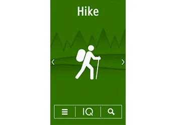
Connect IQ™ (downloadable watch faces, data fields and apps)
Smart notifications on handheld
Weather forecasts
Yes (Paperless)
Weather
VIRB® Remote
Pairs with Garmin Connect™ Mobile
Safety and Tracking Features
LiveTrack
Tactical Features
XERO™ Locations
Outdoor Recreation
Point-to-point navigation
Area calculation
Fish forecast
Sun and moon information
Geocaching-friendly
yes (Geocache Live)
ustom maps compatible
yes (500 custom map tiles)
Picture viewer
Camera
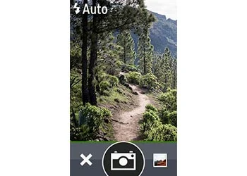
yes (8 megapixel with autofocus; digital zoom)
LED beacon flashlight
Connections
Connections Wireless Connectivity
yes (Wi-Fi®, BLUETOOTH®, ANT+®)