Skip to content

GPSMAP® 723

Durable devices that go wherever you go and track your precise location in the process. Go farther than ever before when hiking and finding adventure.

Watch Video

THE CHOICE IS YOURS

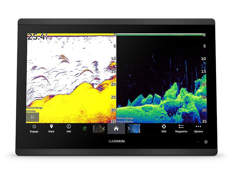
See fish and structure in maximum detail when you pick your display color, your location and your sonar for your day on the water with the STRIKER Vivid 4cv fishfinder with transducer.

Easily integrate with more engines

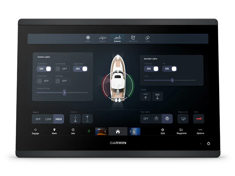
Connect to compatible third-party devices with digital switching and OneHelm™ integrations.

Easily build your marine system by using our advanced network connectivity.

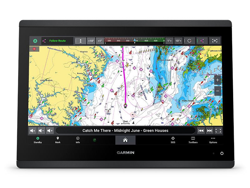
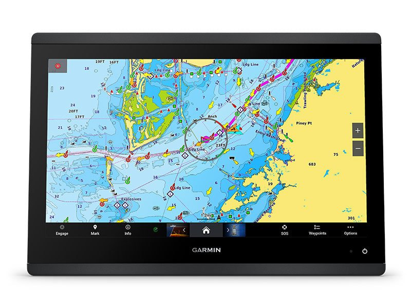
Navigate any waters with preloaded Garmin Navionics+™ charts on select models.

See below your boat with built-in sonar capabilities on select models

Manage your marine experience from nearly anywhere1.

BRIGHT AND CLEAR OPTICS

High-resolution IPS displays for 9”, 12” or 16” chartplotters offer improved sunlight readability and visibility from any angle.

LIVE SONAR SUPPORT

Pair with Panoptix™ or LiveScope™ easy-to-interpret live sonar (transducer required, sold separately) to see all around your boat in real time.

FASTER, SHARPER, SMARTER

With its added processing power and slimline design featuring edge-to-edge glass, it’s easy to fit this plotter in a wider range of dash configurations.

ULTRA HIGH-DEFINITION

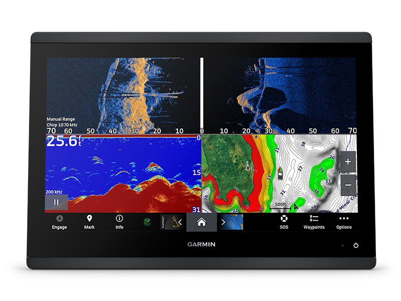
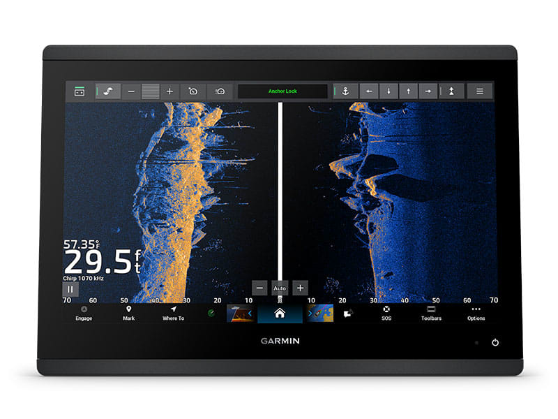
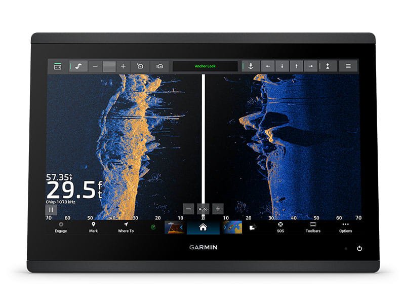
Get built-in Ultra High-Definition SideVü™ and ClearVü™ scanning sonars with vivid, high-contrast color palettes to help distinguish fish from structure. The GPSMAP X3 chartplotter series also supports 1 kW traditional sonar capabilities.

PRELOADED MAPPING

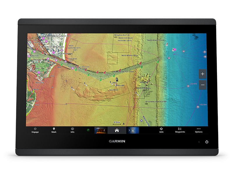
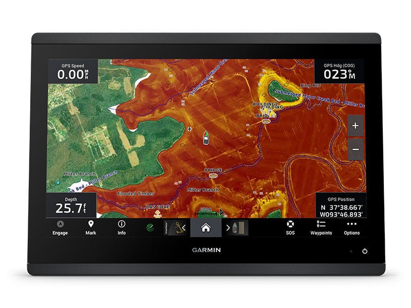
Experience unparalleled coverage and detail with built-in Garmin Navionics+™ integrated coastal and inland mapping that includes Auto Guidance+™ technology2 and a 1-year subscription for downloadable daily updates and more on select chartplotters.

OPTIONAL CHARTS AND MAPS

Bring a fresh new look and feel to your chartplotter with an optional upgrade to a Garmin Navionics Vision+™ premium chart subscription, featuring downloadable high-resolution relief shading, satellite imagery, sonar imagery and more.

See the world below.

OPTIONAL RADAR BUNDLE

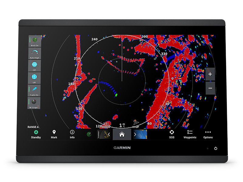
To help you avoid weather and traffic on the water, the compact 4 kW GMR™ 18 HD3 dome radar is available as a bundled option with select GPSMAP chartplotter/sonar packages.

TROLLING MOTOR INTEGRATION

Get support and integration for your Force trolling motor (sold separately) to gain complete control while you fish.

SAILING POLARS

To catch more fish, you need to know where the fish are biting. Use waypoint marking for hot spots so you can easily find your way back.

SAILING FEATURES

View laylines, race start line guidance, enhanced wind rose, heading and course-over-ground lines, true wind data fields and tide/current/time slider, wind angle, set and drift, wind speed and more.

GARMIN MARINE NETWORK

If you have multiple compatible Garmin devices on your boat, you can share information — such as maps, user data, radar and IP camera video — among them.

ACTIVECAPTAIN® APP

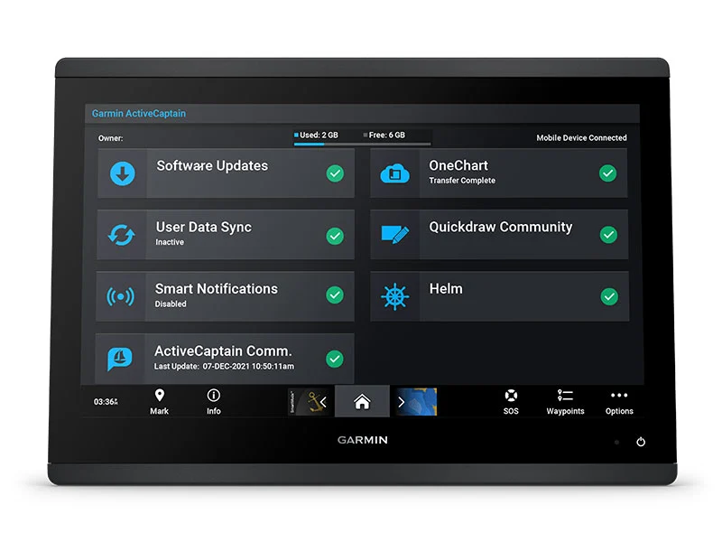
Built-in Wi-Fi® connectivity pairs with the free all-in-one mobile app for access to the OneChart™ feature, smart notifications, software updates, Helm app, Garmin Quickdraw™ Community data and more1.

Made for your helm.

ENGINE CONNECTIVITY

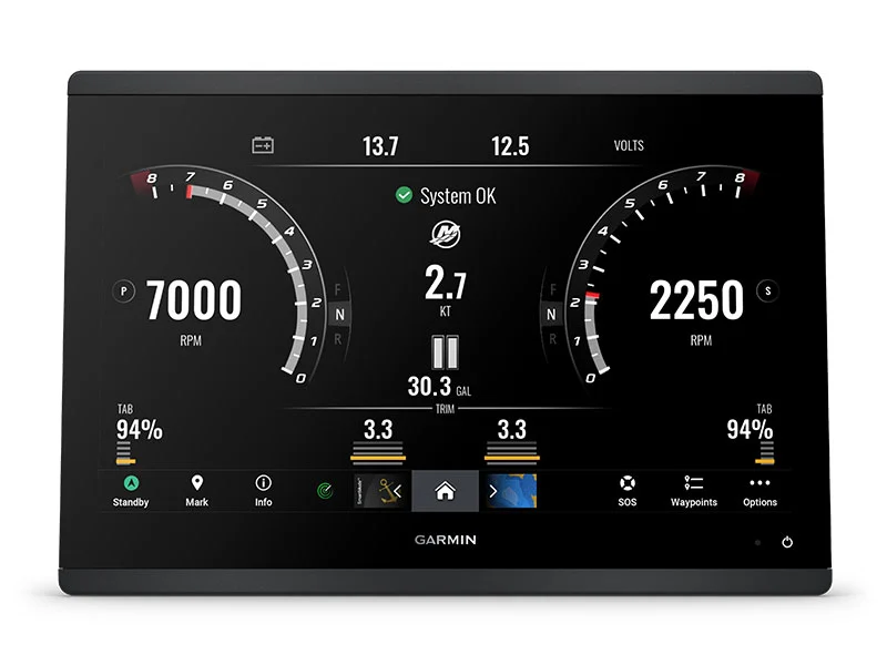
You can connect your chartplotter to different engines, including select Yamaha® engines.

ONEHELM FEATURE

This feature brings together all the operations and capabilities of select third-party devices, such as EmpirBus™ digital switching, on one screen.

NMEA 0183 NETWORKS

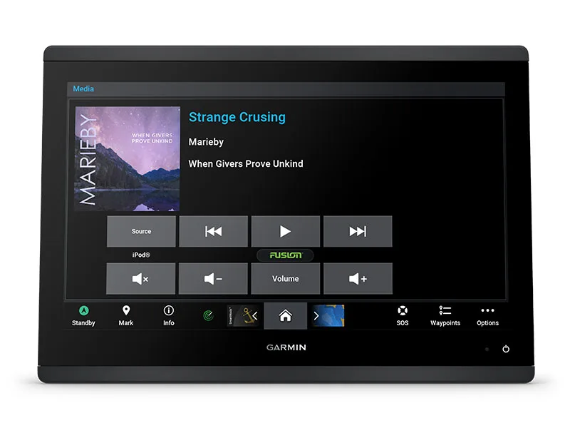
Connect to compatible autopilots, digital switching, weather, the Fusion audio system, media, VHF, AIS and more from one screen.

Sail and navigate with ease.

Specification

General
Dimension
7.6″ x 5.5″ x 2.9″ (19.2 x 14.0 x 7.4 cm)
Weight
2.8 lbs (1.3 kg)
Water rating
IPX7
Has built-in receiver
✓
DISPLAY TYPE
WSVGA
DISPLAY SIZE
6.1″ x 3.5″; 7.0″ diagonal (15.4 x 9.1 cm; 17.8 cm diagonal)
DISPLAY RESOLUTION
1024 x 600 pixels
Mounting options
Bail, flush or flat (Garmin does not offer any hardware or accessories for a flat-mount installation. Professional tools and knowledge is required.)
INPUT
Touchscreen
Maps & memory
Accepts Data Cards
2 microSD™ cards (back of unit)
Waypoints
5,000
Track points
50,000
Tracks
50 saved tracks
Navigation Routes
100
Sensors
GPS
✓
GLONASS
✓
GALILEO
✓
Has built-in receiver
✓
Receiver
10 Hz
NMEA 2000® compatible
✓
NMEA 0183 Compatible
✓
Supports WAAS
✓
Built-in maps
Tide tables
✓
Optional map support
BLUECHART G3
✓
BLUECHART G3 VISION
✓
LAKEVÜ G3
✓
LAKEVÜ G3 ULTRA
✓
GARMIN NAVIONICS+™
✓
GARMIN NAVIONICS VISION+™
✓
TOPO 100K
✓
STANDARD MAPPING
✓
GARMIN QUICKDRAW CONTOURS
✓
Raster chart support
✓
Chartplotter features
Garmin SmartMode compatible (customisable monitor presets)
✓
AIS
✓
DSC
✓
SUPPORTS FUSION-LINK™ COMPATIBLE RADIOS
✓
GSD Black Box Sonar Support
✓
GCV Black Box Sonar Support
✓
ACTIVECAPTAIN MOBILE PLANNING COMPATIBLE
yes
GRID (Garmin Remote Input Device) compatible
✓
Wireless Remote Compatible
✓
Sailing features
✓
Spoken audio alerts
✓
OneHelm support
✓
Electrical Features
Power input
10 to 32 Vdc
Typical current draw at 12 VDC
1.08 A
Maximum current draw at 12 VDC
1.45 A
Maximum power usage at 10 VDC
17.6W
Sonar features & specifications
Displays sonar
✓
Traditional sonar (dual frequency/beam)
Yes (with GCV™ black box, sold separately)
Autogain (minimizes clutter, maximizes targets)
yes (with GCV™ black box, sold separately)
SideVü
Yes (with GCV™ black box, sold separately)
Panoptix™ sonar
✓
LiveScope
✓
Connections
NMEA 2000® PORTS
1
NMEA 0183 Input (Rx) Ports
1
NMEA 0183 output (Tx) ports
1
Video input ports
1 (BNC composite)
J1939 ports
1
Mark waypoints on map
✓
Garmin Marine Network Ports
1
USB ports
✓
BLUETOOTH® pairing
✓
ANT® (Connectivity)
✓
Garmin Wi-Fi network (local connection)
✓